Soil Information System of Thailand
|
Soil Information System of Thailand |
MCC was commissioned by Department of Land Development (DLD), Ministry of Agriculture to design and build spatial databases for their published soil group maps with other data layers such as administrative boundaries, main roads and streams.
Objectives:
The purpose of this project is to develop DLD Soil Information System (DLDSIS) that allow a user to select an area of interest, retrieve the above spatial information and be able to retrieve information on soil types and their suitability level for selected crops.
System Components:
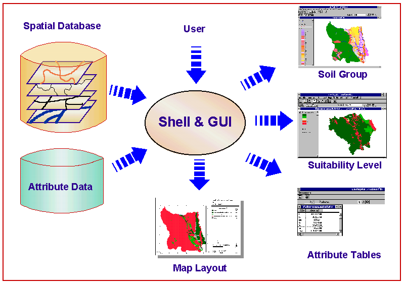
DLDSIS consists of three main components, spatial database, soil group attribute, ArcView GIS and user interface shell (Figure 1)
Fugure 1 Shell Structure
Spatial Database was created by digitizing 1:50,000 soil group maps, abministrative boundary at Tambon (sub-district level), main roads and streams. The database covers north, central, and northeastern regions of Thailand. They are stored as Arc/INFO coverages and ArcView shape files.
Attribute tables containing soil group names and their associate suitability levels for use in producing major crops in Thailand were created and linked with spatial database to facilitate land use planning.
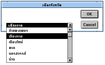
Fugure 2 Select area by administrative name
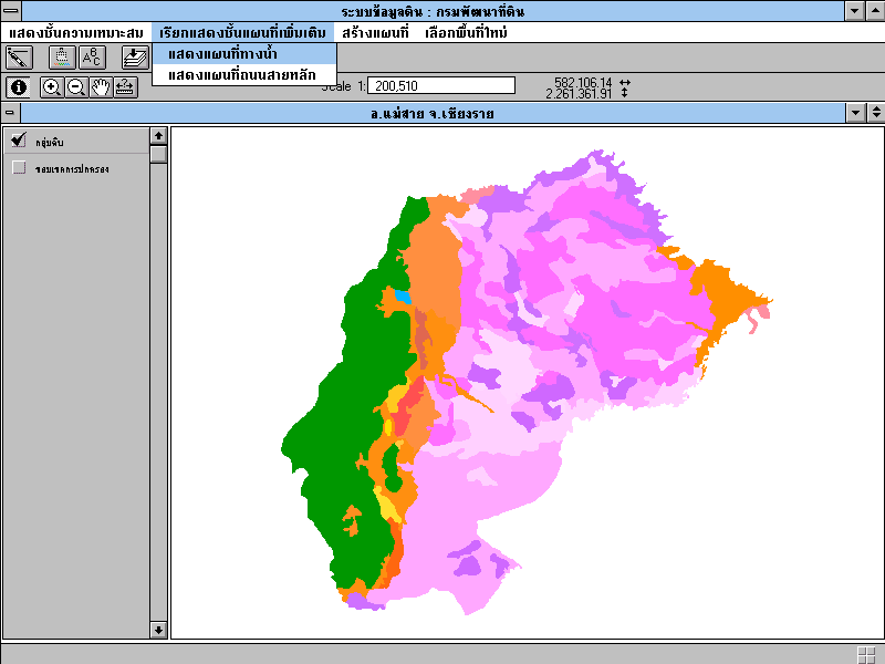
Fugure 3 View soil group of selected area
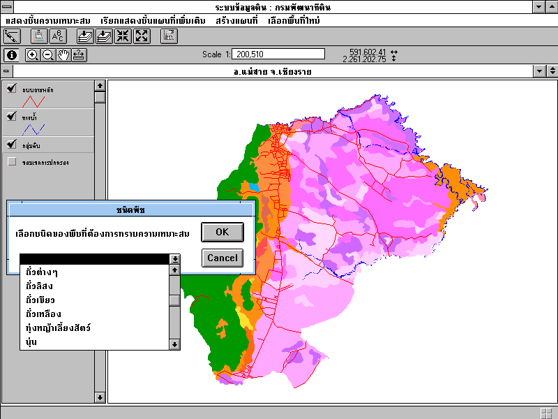
Figure 4 Select crop to assess the suitability
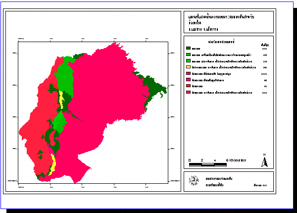
Figure 5 Output map of selected area with suitability level of selected crop
Published Reports::
1. Promburom, P and M. Ekasingh. 1996. DLD Soil Information System: A Structural Components. Agricultural Technical Report No. 40. Multiple Cropping Center, Chiang Mai University, 64p.
2. Promburom, P. and M. Ekasingh. 1996. DLD Soil Inforamation System: A User Manual. Agricultural Technical Report No. 41. Multiple Cropping Center, Chiang Mai University, 30p.
For more information please contact: Panomsak Promburom
Back to DSSARM
| MCC
Home |About MCC | Sustainable
Agriculture | Decision Support Systems | Agri-business&Management
|
| Graduate Program | Supporting Units
| Related Links | Search | Publications | Events | CMU Home |